QINSy 8.1

Is a hydrographic data acquisition, navigation and processing software package
5 
Rating
Your vote:
Latest version:
11.04.15 See all
Screenshots
1 / 4
Download

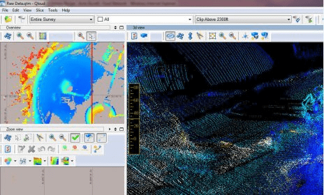
QINSy (Quality Integrated Navigation System) is a hydrographic data acquisition, navigation and processing software package. The suite of applications can be used for various types of surveys, ranging from simple single beam surveys up to complex offshore construction works.

Comments

5 stars
5
4 stars
0
3 stars
0
2 stars
0
1 stars
0
User

Your vote:

Related software

Concise Beam
Concise Beam
rating

Create precast concrete beams as per design codes.

Trimble Heavy Civil Construction Installation Manager
Trimble Heavy Civil Construction
Free
rating

This program installs the application updates and licenses to your controller.

NBS Create
NBS Create
rating

Produce professional outline.

The Survey System
The Survey System
rating

Complete survey software package.

ICDAS Epidemiological Surveys
Free
rating

Create and get statistics about the data gathered in dental surveys.

Related suggestions

Qinsy torrent download
Qinsy software torrent
Qinsy 8
Qinsy 8.0 32 bit
Qinsy 8.0 64 bit
Qinsy software download